How the Tide Turns at the Mouth of the Elbe
NASA imagery shows how tidal shifts reshape the Elbe River’s mouth in Germany, impacting shipping, ecosystems, and flood risks along a critical European waterway.
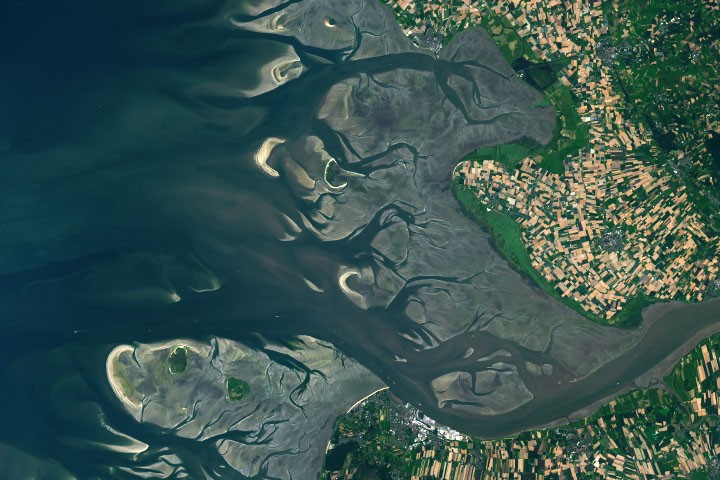
The Elbe River’s mouth in Germany undergoes dramatic changes between low and high tides, as shown in NASA Landsat 9 images from May and August 2025. The area features a 2.9-meter tidal range, exposing sandbars and mudflats at low tide while submerging most features at high tide. These shifts create challenges for navigation, particularly for ships accessing Hamburg, the EU’s third-largest container port, which requires dredging to maintain the channel.
The Wadden Sea, a UNESCO World Heritage Site, spans the region and supports over 10 million migratory birds annually. A navigable channel near the river’s mouth connects to the Kiel Canal, the world’s busiest artificial waterway. However, vessels often rely on high tide to pass safely, as sediment buildup and tidal asymmetry—where flood currents carry more sediment upstream—complicate passage.
Historical records show extreme storm surges, such as a 5.1-meter water level at Cuxhaven in 1976, worsened by storm timing relative to tides. Rising sea levels, increasing by 2.12 millimeters per year at Cuxhaven, heighten flood risks in low-lying coastal areas. Scientists use these data to model future storm impacts and improve flood defenses.
New satellite missions, including NASA’s SWOT and the upcoming NISAR, aim to enhance coastal water level measurements. SWOT has already demonstrated improved tidal modeling, while NISAR’s radar will track long-term sea level changes and flood events. These tools support efforts to mitigate risks in vulnerable regions like the Elbe estuary.