Before the Dawn in America’s Heartland
An astronaut aboard the International Space Station captured a predawn view of the U.S. Midwest’s illuminated cities, highlighting urban lighting patterns and atmospheric phenomena.
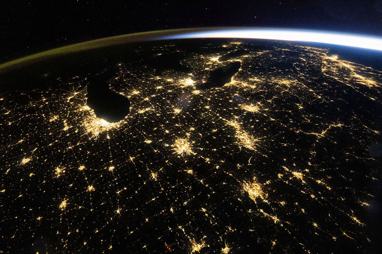
An astronaut aboard the International Space Station photographed the U.S. Midwest at 4:54 a.m. Central Daylight Time on October 18, 2026, capturing a clear view of nighttime lights across the region. The image prominently features major cities like Chicago and Detroit, alongside mid-sized urban centers such as Indianapolis, Cincinnati, and Louisville. The photograph also reveals a band of green and orange airglow along the horizon, a natural atmospheric phenomenon caused by sunlight interacting with upper-atmospheric atoms and molecules.
The astronaut’s wide-angle shot provides a broad perspective of the Midwest’s urban landscape, with state and interstate highways forming visible connections between cities. Sunrise was approaching on the East Coast, while Chicago still had roughly two hours before daylight. The image underscores the value of nighttime photography from space for scientific analysis of urban environments and infrastructure.
NASA researchers use astronaut photographs and satellite data to study urban lighting patterns, distinguishing between different types of artificial lighting within cityscapes. The agency’s Gateway to Astronaut Photography of Earth archive enables detailed analysis of lighting types, brightness, and spatial distribution to track urban growth and infrastructure changes.
NASA’s Black Marble nighttime lights product suite, derived from satellite observations, provides global records of nighttime lighting at daily, monthly, and yearly intervals. Scientists leverage these data to monitor power outages, infrastructure development, and transitions to energy-efficient lighting such as LEDs across the eastern United States.