How 2 US, European Satellites Are Studying Hurricanes During El Niño
NASA and European partners launched Sentinel-6B to track sea levels and hurricanes during a strong El Niño, enhancing storm forecasts and disaster response with precise ocean data.
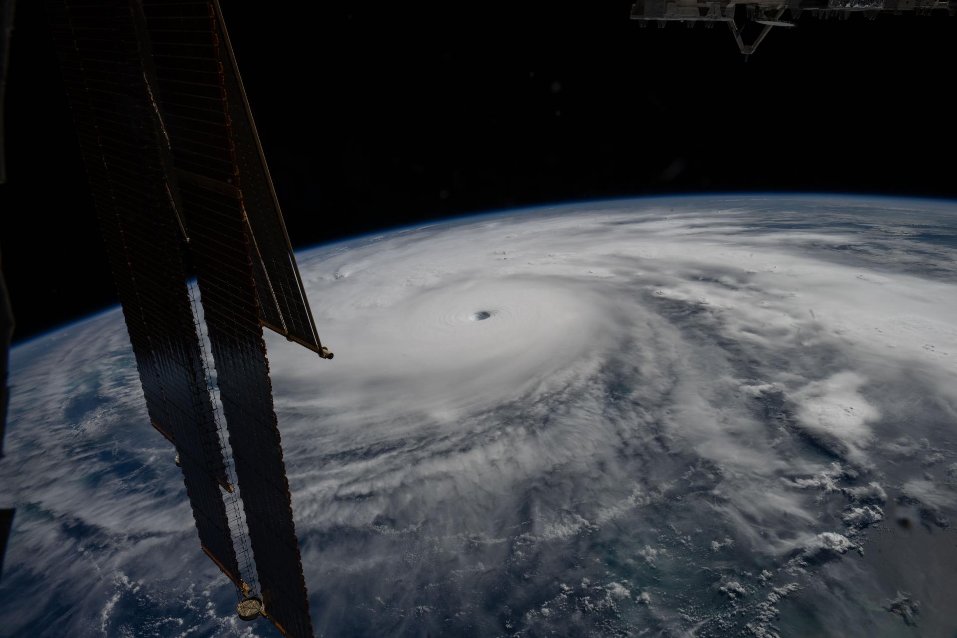
In November, NASA and its European partners deployed the Sentinel-6B satellite to advance hurricane forecasting and protect infrastructure, including shipping routes. Flying 30 seconds behind its predecessor, Sentinel-6 Michael Freilich, the satellite measures sea level height with high precision during an expected historic El Niño event. The Copernicus Sentinel-6/Jason-CS mission, operational since the early 1990s, provides continuous ocean observations that help scientists understand El Niño’s impacts and improve hurricane predictions.
The current El Niño, described by NASA’s Josh Willis as a late-bloomer, began mid-year and now rivals the strength of significant events in 1997 and 2015. El Niños disrupt global weather patterns, redistributing ocean heat and shifting hurricane activity from the Atlantic to the Pacific. Sentinel-6B started delivering low-latency data on July 15, which will enhance weather prediction models used by meteorologists and climate scientists to inform disaster response efforts.
Data from the Sentinel-6 satellites feeds into hurricane tracking algorithms managed by federal and state agencies, enabling timely evacuations and resource mobilization. A tropical storm can take over a week to intensify into a hurricane, but rapid intensification in the 48 hours before landfall leaves little preparation time. NOAA’s Deirdre Byrne oversees the Satellite Ocean Heat Content Suite, which relies on ocean height measurements to forecast hurricane strength and guide emergency decisions.
Each Sentinel-6 satellite uses a radar altimeter to measure ocean height, wave size, and wind speed, while the GNSS-RO instrument captures atmospheric data like humidity and temperature. The ocean height data, critical for hurricane forecasting, will be integrated into NOAA’s algorithm by the end of the year. Sentinel-6B will soon replace Sentinel-6 Michael Freilich as the reference satellite for global sea level measurements, extending a four-decade dataset that began with TOPEX/Poseidon in 1992.