US-India Satellite Captures Time-lapse Video of Volcanic Eruption
A NASA-ISRO satellite captured a time-lapse of Krasheninnikov volcano’s first eruption in 475 years, demonstrating its ability to monitor remote natural hazards with high-resolution radar.
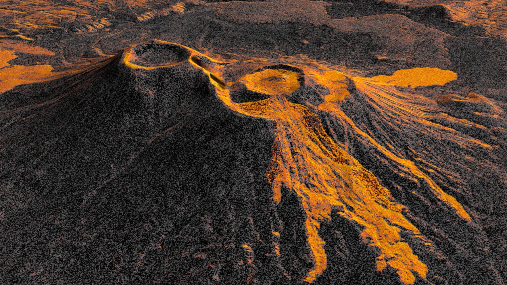
On July 30, 2025, an 8.8-magnitude earthquake near Russia’s Kamchatka Peninsula triggered the first eruption of Krasheninnikov volcano in nearly five centuries. The NASA-ISRO Synthetic Aperture Radar (NISAR) mission, positioned 464 miles above Earth, began tracking the eruption shortly after the satellite became operational in late December 2025. Using its L-band radar, NISAR captured detailed radar images of the volcano’s lava flows, revealing the progression of molten rock filling and overflowing craters.
Researchers compiled 17 radar frames into a time-lapse video, showing lava expanding from a smaller inner caldera into a wider crater and forming a fan-shaped flow. The animation underscores NISAR’s capability to monitor natural hazards, offering data valuable for scientific research and potential emergency response. The satellite’s near-global coverage and high-resolution imaging—down to tens of feet—enabled it to observe the remote volcano despite its decades-long dormancy.
Matthew Pritchard, a NISAR science team member and Cornell University geophysicist, highlighted the satellite’s consistency in capturing high-resolution images twice every 12 days. Each pixel in the images represents a 30-foot-by-30-foot area, with lava appearing brighter due to its reflective properties. The time-lapse also revealed an earlier lava flow to the northwest, unseen in initial NISAR images, demonstrating the satellite’s precision in tracking volcanic activity over time.
NISAR is the first free-flying mission to carry two radar instruments—L-band and S-band—complementing each other with different wavelengths. The L-band radar, provided by NASA’s Jet Propulsion Laboratory, can penetrate tree canopies, while the S-band, supplied by ISRO, observes vegetation. Data from the mission is available via the Alaska Satellite Facility, supporting global monitoring of Earth’s surface changes as small as a centimeter.