How Agentic AI Transforms Earth Observation Into Actionable Intelligence
Planet Labs has launched an agentic geospatial AI tool in private beta, enabling users to query satellite imagery using natural language to detect construction sites and other changes without requiring GIS expertise.
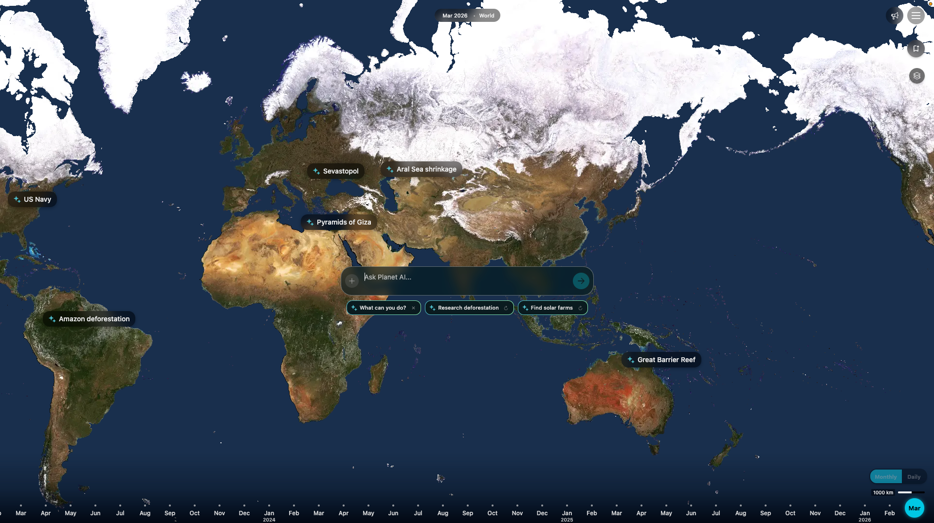
Planet Labs’ new agentic geospatial AI allows users to type natural language queries, such as identifying new construction sites in Florida, and receive instant, map-based reports without manual image analysis or GIS skills. The tool integrates satellite data, AI-driven change detection, and public records to deliver actionable insights through a chat interface, reducing the time required for analysis from days or weeks to seconds. This addresses the longstanding challenge of turning abundant Earth observation data into timely intelligence for decision-making. The system is currently available in private beta, with a waitlist open for interested participants.
Earth observation data from Planet’s satellites covers the entire landmass and 20 million square kilometers of open water daily, with an archive spanning eight years of near-daily scans. While the volume of data has grown, traditional methods of processing it often involve time-consuming manual steps and specialized expertise, delaying insights. Planet’s agentic AI aims to automate these workflows, enabling users to focus on interpreting results rather than managing data pipelines. The tool’s ability to synthesize imagery, public data, and AI analysis into shareable reports marks a shift toward more efficient geospatial research.
The agentic AI system operates in two modes: quick queries return immediate results, while deeper investigations analyze changes over time, interpret visual features like land clearing or new foundations, and compile detailed reports with embedded satellite imagery. This dual approach allows users to balance speed and thoroughness depending on their needs. For example, monitoring industrial construction or verifying infrastructure projects can now be done with greater precision and reduced effort. The automation of complex geospatial tasks shortens decision-making cycles, enabling organizations to respond to environmental or operational changes more rapidly.
Planet Labs envisions a future where AI models trained on Earth observation data, termed Planetary Intelligence, can identify meaningful anomalies and support proactive management of global challenges. The agentic geospatial AI represents a step toward this vision by making geospatial insights accessible through natural language queries. The company is accepting participants for its private beta program, offering hands-on experience with the chat interface and an opportunity to shape the product’s development. Further details and a demonstration are available in an Agile EO webinar hosted by Planet’s product experts.