How Do Earth Observation Analytics Detect Objects, Changes, and Patterns at Scale?
Earth observation analytics convert vast satellite imagery into actionable intelligence using AI, machine learning, and spatial processing, enabling automated detection of objects, changes, and patterns at scale.
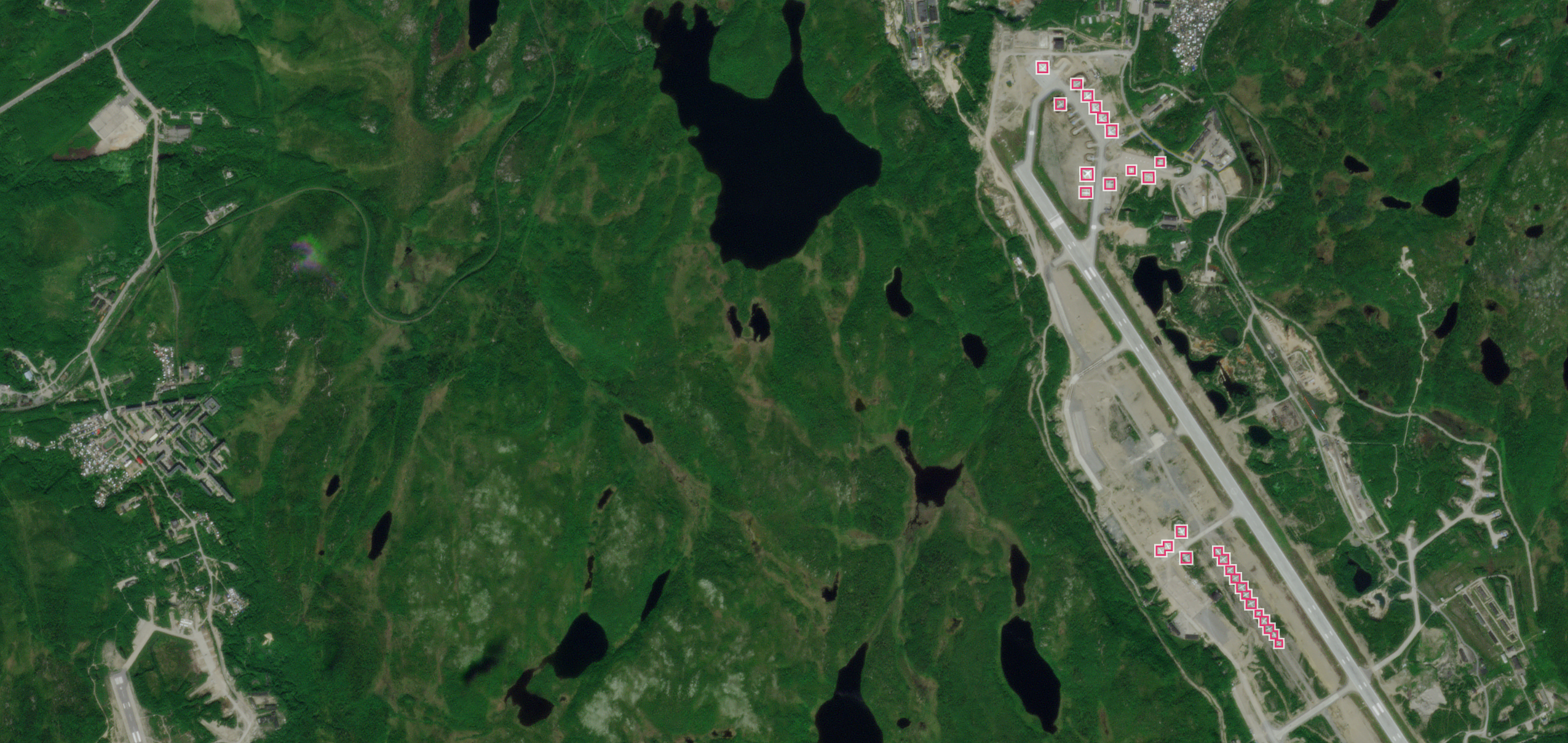
Satellites generate daily imagery of Earth’s surface, creating challenges in manual review and visual inspection. Earth observation (EO) analytics address this by employing computer vision, deep learning, and spatial processing to transform raw data into targeted intelligence. Methods include spectral and time-series analysis, alongside AI-driven tasks such as object detection and land cover classification. The process begins with cleaning and calibrating large datasets to ensure consistency, followed by applying analytical techniques tailored to specific questions. Outputs such as object counts or change measurements are delivered as structured data feeds for integration into monitoring systems and operational workflows.
Machine learning models, including convolutional neural networks (CNNs), are trained to detect man-made and natural features in satellite imagery. Detection accuracy depends on spatial resolution, atmospheric conditions like cloud cover, and temporal resolution—the frequency of imaging. High-resolution data identifies specific objects, while high-cadence imaging, such as from PlanetScope®, captures changes as they occur. EO analytics become more valuable when integrated into systems that convert detections into automated alerts and decision-support workflows, such as the Planet Global Monitoring System, which issues real-time anomaly alerts for areas of interest.
Automated change detection compares images of the same location taken at different times to identify meaningful events, such as new construction or land clearing. The software filters out seasonal variations like snow cover or shadows to highlight significant activities. Users define areas of interest (AOIs) using geospatial software, allowing machine learning models to isolate and analyze specific zones. This targeted approach triggers timely alerts for key events, such as new roads or structures, enabling continuous monitoring of large asset portfolios without data overload.
AI serves as the engine for classifying and interpreting billions of pixels in satellite imagery, trained on labeled datasets to recognize complex patterns with high precision. These systems detect subtle indicators of change, such as early crop stress or minor industrial shifts, that may elude human observers. EO analytics also identify broad patterns like urban expansion, deforestation rates, or supply chain shifts by aggregating data from thousands of locations. Researchers use these insights to track economic activity or assess the impact of natural disasters on local environments.