What Are the Core Characteristics of Satellite Imagery Resolution?
Planet Labs explains the three core characteristics of satellite imagery resolution—spatial, temporal, and spectral—and their trade-offs for different use cases.
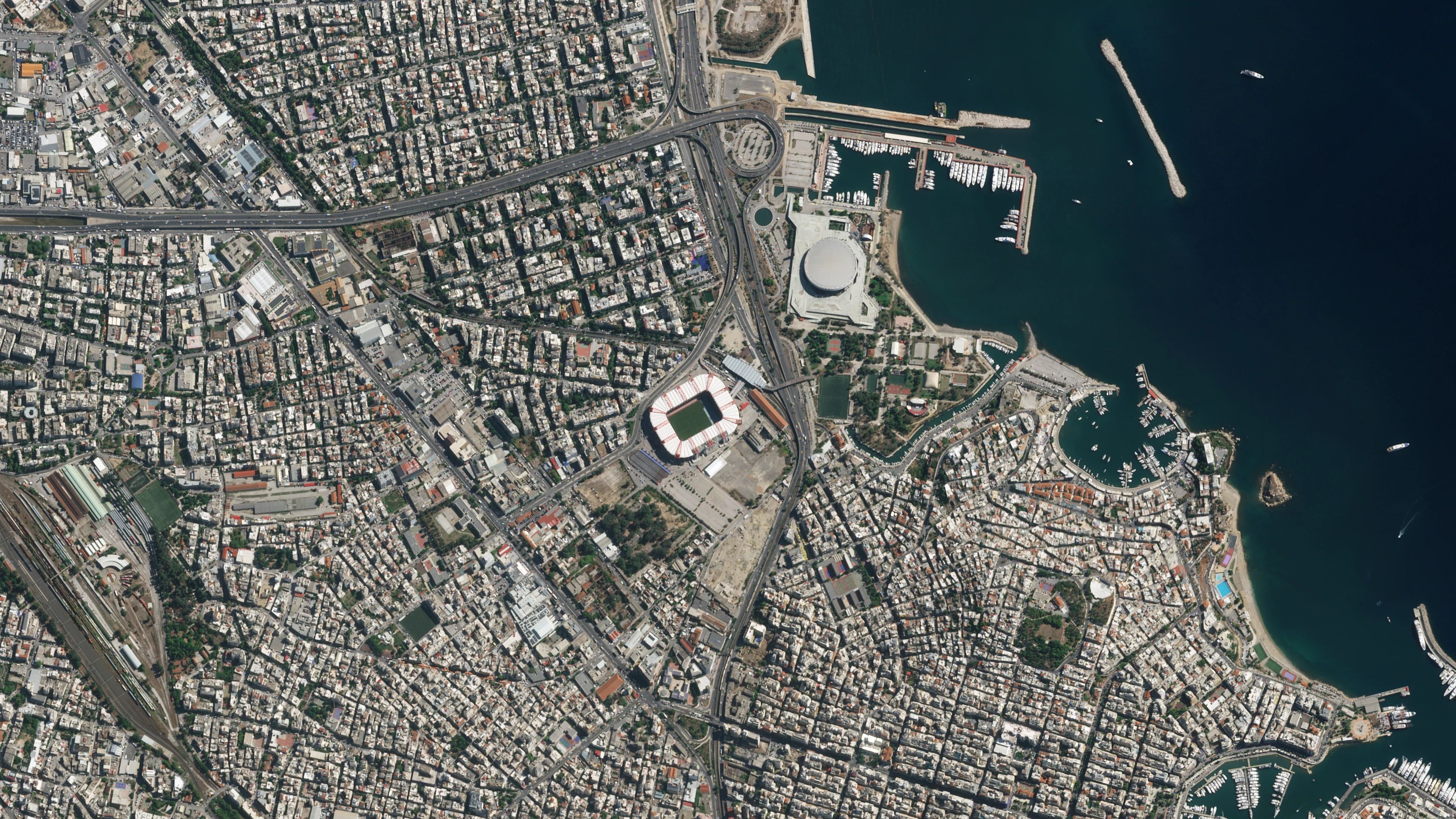
Spatial resolution defines the ground area represented by each pixel in a satellite image, with higher values offering greater detail. For example, a three-meter resolution means each pixel covers a 3m-by-3m area, enabling identification of individual structures or vessels. Lower resolutions, such as 10 meters per pixel, produce blurrier images better suited for broad regional analysis rather than fine details. The choice of resolution depends on the specific analytical needs and resource constraints, as higher resolutions require more storage, processing power, and often higher costs.
Temporal resolution, or revisit rate, measures how frequently a satellite revisits a specific location. Constellations with more satellites can achieve near-daily coverage, while single satellites may revisit areas only every few weeks. High temporal resolution is critical for monitoring dynamic events like floods, crop growth, or construction progress. Multiple sensors working in tandem reduce observation gaps, enabling real-time change detection rather than delayed assessments after an event has occurred.
Spectral resolution refers to a satellite sensor’s ability to distinguish between different light wavelengths, including visible, near-infrared (NIR), and shortwave infrared (SWIR) bands. Visible bands replicate human vision, while NIR helps assess vegetation health due to plants’ strong reflection of these wavelengths. SWIR bands detect soil moisture or heat, and hyperspectral sensors like Planet’s Tanager capture over 400 bands, enabling precise tracking of atmospheric emissions such as methane and ammonia.
Image quality is also affected by external factors like cloud cover, atmospheric haze, and sensor calibration. Clouds frequently obscure ground features, particularly in tropical or temperate regions, while haze and smoke scatter light, reducing image sharpness. The sun’s position and satellite angle can create shadows that hide key details. Consistent processing and calibration are necessary to correct these variables, ensuring satellite data remains accurate for scientific or commercial applications.